| Volume
81
Isla San Marcos
On our way north from
Bahia Concepcion to the town and marina of Santa Rosalia, we stopped
for a few days at Isla San Marcos, about 31 miles north of Playa
Domingo. After miles and miles of utterly desolate and untouched
Baja coastline, it is almost startling to come upon San Marcos where
the southern end is devoted to a huge and complex gypsum mining
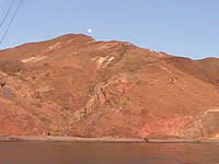
operation and the village that supports it. Although the open pits
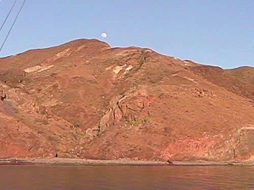
mines so far are only at the south end, the whole island appears
to be made of the same stuff, giving it a kind of smooth, brown,
felt-like look with little vegetation. Gypsum is a component of
plaster of Paris and dry wall, and so this remote corner of the
world sees huge bulk carriers coming to carry it away.
 At
the other end of the five-mile long island, however, are two small
anchorages on the northwest face with protection to summer's usual
southeasterlies. We chose the one behind Punta Piedra Blanca in
a wide circle of sand. From the boat, there was nothing particularly
pretty about this spot, which was surrounded by craggy dark brown
rock, and if I hadn't gone for an early morning kayak tour, we might
have blown it off with little more investigation. By kayak, though,
the coast revealed itself to be an intriguing maze of submerged
rocks and finger-like inlets begging to be snorkeled. There is,
in my mind, a definite correlation between intriguing kayaking and
good snorkeling. In both activities I like nooks and crannies. This
shoreline was the kind that tempted me further and further along,
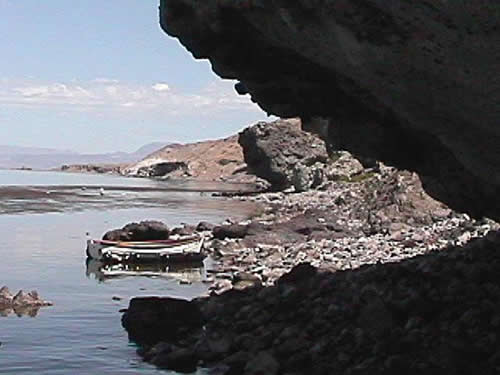
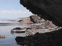
and around the point I found myself in the next "anchorage"
called Caleta de Los Arcos. As the name suggests, there are several
arches and caves inset into the coastline big enough to paddle right
into. The anchorage, however, seemed more exposed to a wraparound
effect from the north point, and the circle of good sand bottom
seemed cramped for more than one boat. At
the other end of the five-mile long island, however, are two small
anchorages on the northwest face with protection to summer's usual
southeasterlies. We chose the one behind Punta Piedra Blanca in
a wide circle of sand. From the boat, there was nothing particularly
pretty about this spot, which was surrounded by craggy dark brown
rock, and if I hadn't gone for an early morning kayak tour, we might
have blown it off with little more investigation. By kayak, though,
the coast revealed itself to be an intriguing maze of submerged
rocks and finger-like inlets begging to be snorkeled. There is,
in my mind, a definite correlation between intriguing kayaking and
good snorkeling. In both activities I like nooks and crannies. This
shoreline was the kind that tempted me further and further along,
and around the point I found myself in the next "anchorage"
called Caleta de Los Arcos. As the name suggests, there are several
arches and caves inset into the coastline big enough to paddle right
into. The anchorage, however, seemed more exposed to a wraparound
effect from the north point, and the circle of good sand bottom
seemed cramped for more than one boat.
In the afternoon we returned
to the nooks and crannies with snorkel gear and spearguns and we
spent a very pleasant couple of hours tooling through the maze.
The viz could have been better. It was maybe 15' from the surface,
but, you know, sometimes a little murk enhances the mystery of a
spot. When you dove down below that 15', there was suddenly revealed
a very busy landscape of boulders with many good eating fish darting
among them.
 We
really could have spent a long time poking along these shores, and
we were keen to do some dinghy fishing off the northern point where
yellowtail and dorado were reputed to be. Two factors, however,
pushed us on. Most directly, the wind seemed to be shifting more
northeasterly and the wraparound effect was beginning to reach us
in even the more protected Piedra Blanca anchorage. Also, there
was just one slip waiting for us at the tiny Santa Rosalia Marina,
and our plan was to leave T2 there for a week while we adventured
north by bus to San Diego and LA for some friends' wedding and to
visit daughter Tiffany and her fiancé Derek. If we lost the
slip, the whole plan would be screwed up, so we hastened on the
ten more miles to Santa Rosalia. We
really could have spent a long time poking along these shores, and
we were keen to do some dinghy fishing off the northern point where
yellowtail and dorado were reputed to be. Two factors, however,
pushed us on. Most directly, the wind seemed to be shifting more
northeasterly and the wraparound effect was beginning to reach us
in even the more protected Piedra Blanca anchorage. Also, there
was just one slip waiting for us at the tiny Santa Rosalia Marina,
and our plan was to leave T2 there for a week while we adventured
north by bus to San Diego and LA for some friends' wedding and to
visit daughter Tiffany and her fiancé Derek. If we lost the
slip, the whole plan would be screwed up, so we hastened on the
ten more miles to Santa Rosalia.
Photos courtesy
of Paul Marak, sv Ryokasha.
|